

The state’s wild weather continues to play havoc with public transport, with severe disruption to trains, buses and ferries on Saturday despite cloudless skies.
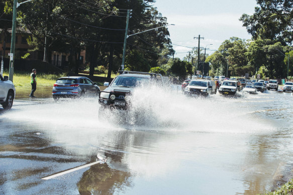
Traffic delays due to flooding on Newbridge Rd in Chipping Norton.Credit: Dion Georgopoulos
A Transport for NSW spokeswoman said motorists and public transport passengers in Sydney and surrounding areas should avoid non-essential travel in flood-affected areas, with some major roads and public transport still subject to flooding.
Train passengers are advised to allow plenty of extra travel time and check their trip.
- T8 Airport & South Line: Shuttle trains are running between Central and Revesby and between Revesby and Macarthur in both directions. Passengers should continue to allow extra travel time as there will be longer than normal service gaps.
- T7 Olympic Park Line: Trains are not running between Lidcombe and Olympic Park. Consider alternative transport.
- South Coast Line: Trains are not running between Waterfall and Bomaderry and also between Wollongong and Port Kembla, due to flooding on the tracks at various locations. Limited replacement buses are running.
- Southern Highlands Line: Buses supplement some trains between Campbelltown and Moss Vale following flooding on the tracks.
- Hunter Line: Trains are not running between Newcastle Interchange and Maitland due to flooding on the tracks at Sandgate.
Most other lines are affected by delays. Passengers are advised to listen to announcements and check information displays for service updates.
Buses are replacing ferries between Parramatta and Rydalmere due to the weir overflowing.
Some F1 Manly Ferry services have been cancelled due to a heavy swell.
Some bus routes across the Sydney bus network are impacted due to localised flooding with local diversions in place.
This map from the Bureau of Meteorology shows just how hard the NSW coast was hit by the heavy downpours.
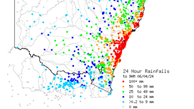
Bureau of Meteorology map showing rainfall over the past 24 hours. Credit: Bureau of Meteorology
The bureau now forecasts a sunny day for the rest of Saturday in Sydney, with a slight chance of a shower. Winds are expected to lighten, while surf conditions remain powerful.
Police have confirmed the body of a man was found in water at Penrith today.
The cause of death has not been established. While parts of Penrith have been told to prepare to evacuate due to flood risks this morning, the man ’s body was located in an area with a lower alert level.
“About 7.45am today (Saturday 6 April 2024), emergency services were called to King Street at Penrith after a member of the public located a man’s body in water near a reserve,” NSW Police said in a statement.
The man has not been formally identified. Police are investigating and will prepare a report for the coroner.
This map shows the areas of Sydney still most at risk of dangerous flooding.
The danger level for the areas surrounding the Narrabeen Lagoon and the Manly Dam have been downgraded to a “return with caution”.
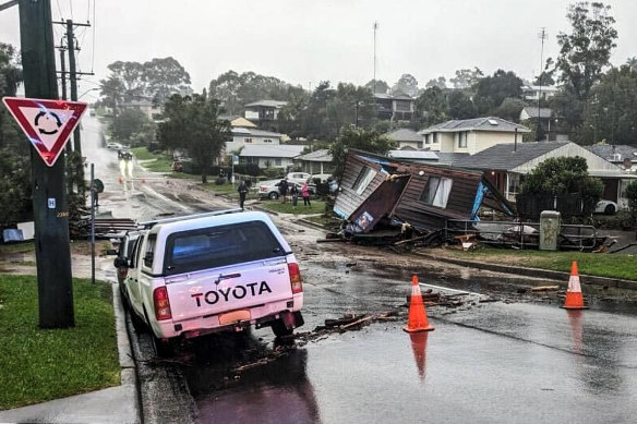
Chipping Norton in the city’s west and surrounds remain under threat, as do parts of Penrith.
In the south-west, residents in low-lying parts of Bonnet Bay and Woronora are still being advised to evacuate.
But the most widespread risk surrounds the city’s north-west and the Hawkesbury region.
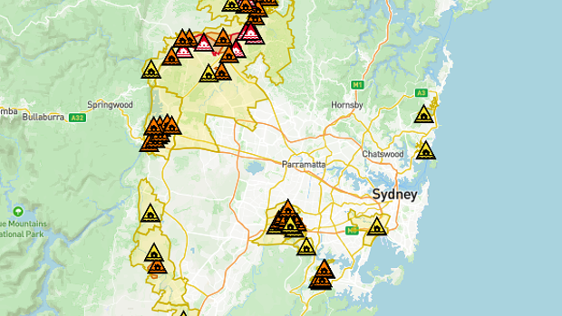
A map of SES evacuation alerts and warning across Sydney. Credit: NSW SES
Premier Chris Minns said the impact of this week’s extreme weather on flood-prone communities in western Sydney justified last year’s decision to stop the building of more than 10,000 homes in the Hawkesbury-Nepean Valley floodplain.
Speaking at the SES headquarters on Saturday, Minns said his government had made a “difficult decision” to stop a dramatic increase in home-building in Sydney’s north-west despite his determination to tackle the city’s housing crisis.
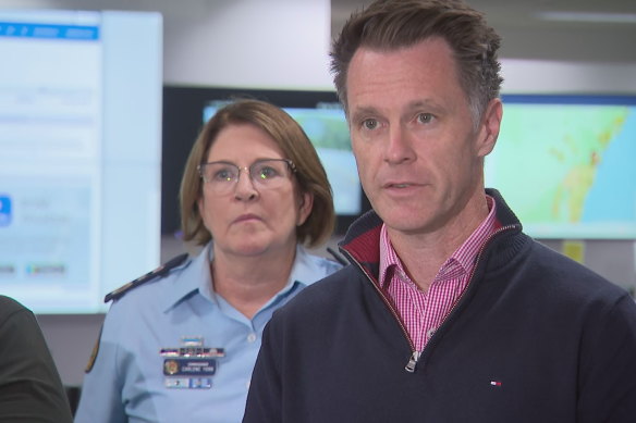
Premier Chris Minns and NSW SES Commissioner Carlene York. Credit: Nine News
Minns said the previous state government had “opened discussions and land release in what we would consider flood-prone communities”.
“We decided in the end that that was too dangerous and it will add to the amount of people that had to evacuate from flood prone areas,” he said.
“We were criticised for it. I think events like today and yesterday prove that it was the right decision although it’s a tough call because obviously we need housing.”
Minns also raised the prospect that some communities may have to be abandoned because of climate change and extreme weather.
Minns said the impact of climate change had already prompted a “massive program” of buying homes and building new communities around Lismore.
“As a result of climate change, you’re going to see increasing weather events like we’ve seen over the last 48 hours,” he said. “Governments are going to have to work with communities to make changes, it’s not going to be easy but it’s obviously necessary.”
WaterNSW has announced that Warragamba dam received 100mm over 6hrs, with up to 200mm in 24hrs in some areas. The dam began to spill at 5.35am.
The water is spilling about 200 gigalitres per day and that rate is expected to rise.
“With the flooding in the Hawkesbury-Nepean Valley the spill will contribute to the
flood waters already in the system,” WaterNSW said.
Cornwallis, near Richmond in Sydney’s north-west, experienced rising moderate flooding on Saturday, as seen in this timelapse by Herald photographer Dean Sewell.
Photographer Nikki Short found these children undeterred by wild conditions at Narrabeen on Sydney’s northern beaches.
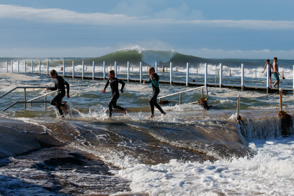
Locals play in the surf at NarrabeenCredit: Nikki Short
Meanwhile the NSW SES posted an image of this home at Mt Keira, destroyed by flooding.
A damaged cabin which was washed into a creek during flooding this morning at Mt Kiera.Credit: SES
Premier Chris Minns
- Parts of NSW received more than 180mm of rain overnight.
- While Sydney may have woken up to blue skies, flood levels are continuing to rise in parts of the city’s west.
- Flooding presents a “real danger” to some communities.
- More than 4000 volunteers have responded to the wild weather event.
- Extensive public transport delays continue.
Carlene York, NSW SES Commissioner
- Evacuations have been carried out overnight and into this morning.
- The SES has performed 152 rescues across NSW, 77 in the Sydney metropolitan region.
- The Yarramundi and Richmond bridges have been closed.
- The SES has responded to more than 2000 incidents.
Steven Bernasconi, Bureau of Meteorology
- The Hawkesbury, Nepean and Colo rivers remain flood risks, with the risk level expected to rise from moderate to major.
- The rain and the wind threat, however, is contracting to the south-east of the state.
- There are 27 severe weather warnings in place for NSW, 20 of which concern flooding.
- Sydney can expect much more average weather on Sunday and Monday.
Risks can be monitored via the Hazards Near Me app.
Read More: World News | Entertainment News | Celeb News
SMH