


-

JAMM AQUINO / JAN. 2, 2023
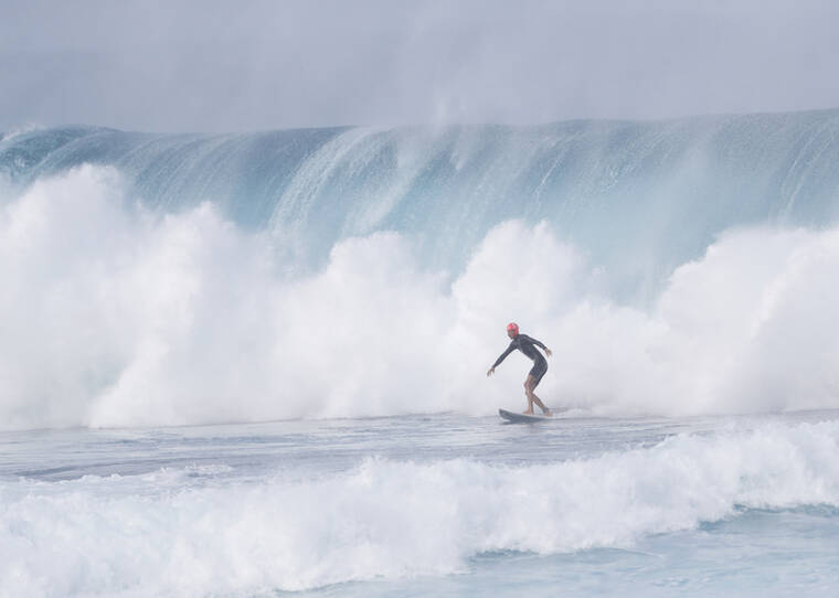
National Weather Service forecasters have issued a high surf warning for the north and west shores of Hawaii’s smaller islands until 6 p.m. today.
A high surf warning for the north and west shores of Hawaii’s smaller islands remains in place until 6 p.m. today.
National Weather Service forecasters expect a large, northwest swell to peak this morning, boosting surf from 25 to 35 feet along north shores, and up to 24 feet along west shores.
The warning covers north and west shores of Niihau, Kauai, Oahu and Molokai, and north shores of Maui.
Surf on the west shores of Hawaii island, meanwhile, is expected to reach up to 8 feet, prompting a high surf advisory for the area until 6 p.m. today.
The swell should gradually decline this afternoon through the weekend, forecasters said, but waves are expected to remain elevated through early next week due to a reinforcing northwest swell arriving late Saturday night.
The public should beware of strong, breaking waves and strong currents along affected shores, which will make swimming dangerous.
Forecasters say a cold front near Hawaii island that’s been bringing “cloudy, gloomy, and showery weather” to some parts of the state is still hanging around today.
Showery weather is expected to continue for Maui and Hawaii counties, especially windward and mauka areas, then gradually ease up this weekend as the front moves to the south of the state.
A wind advisory for Big Island summits — due to west winds of 35 to 45 mph, with gusts near 60 mph — remains in effect until 6 a.m. Saturday.
Click here to see our full coverage of the coronavirus outbreak. Submit your coronavirus news tip.
Read More: World News | Entertainment News | Celeb News
Star Ads